
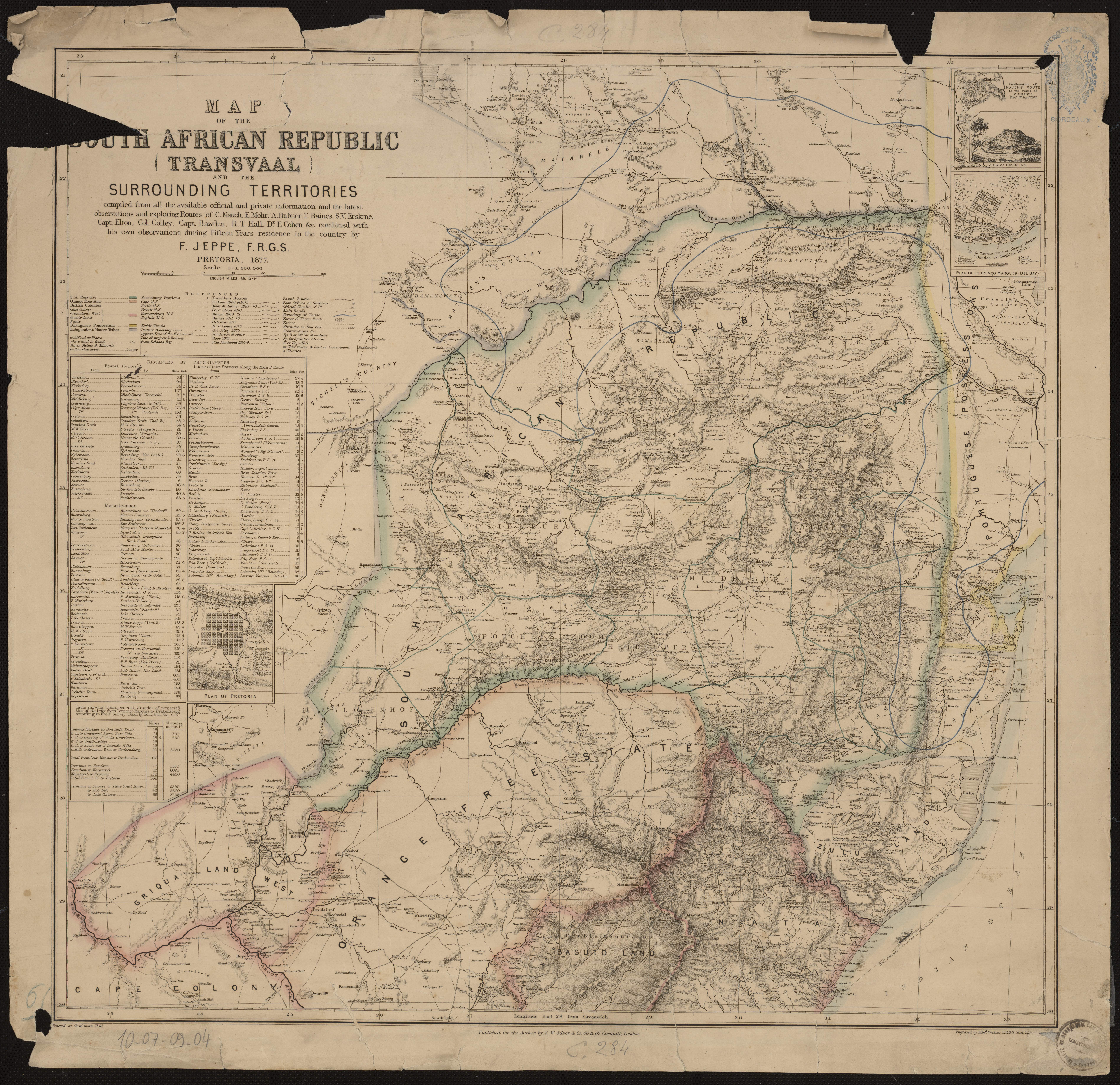
Map of the South African Republic (Transvaal) and the surrounding territories : compiled from ... the ... observations and exploring Routes of C. Mauch, C. Mohr, A. Hubner, T. Baines, S.V. Erskine, Capt. Elton, Col. Colley, Capt. Bawden, R.T. Hall, Dr. E. Cohen, etc. ... / by F. Jeppe, F.R.G.S. Pretoria, 1877
- Auteur(s) : Jeppe, Friedrich
- Editeur : Londres : S. W. Silver & Co. , 1877
- Date de publication : 1877
- Coordonnées : 1:1 850 000 (E 22°30' - E 33°25' / S 20°50' - S 30°)
- Couverture : Afrique centrale et australe
- Format : 1 carte : en coul. ; 61 x 63 cm
- Identifiant(s) : 10-07-09-04
- Conditions d'utilisation : Public Domain mark
Aller à la collection associée :
Ailleurs sur le web
- Ouvrage signalé dans la notice Sudoc n°182147193