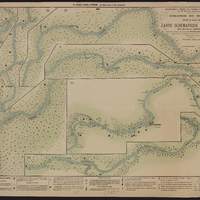
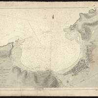
Dans la marge : "3647" et "22". Bathymétrie représentée par des points de sonde, relief représenté par des hachures. Edition originale : 1878. [Corrections] XII-91. Edition d'octobre 1891. Coordonnées géographiques d'après Google Earth
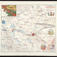
Carton : Carte géologique du département de la Loire-Inférieure / par M. Louis Bureau ; Principales régions et productions agricoles.
Graphiques statistiques sur l'économie ; Tableau : Principaux établissements industriels du groupe nantes-Chantenay en 1905
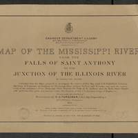
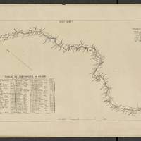
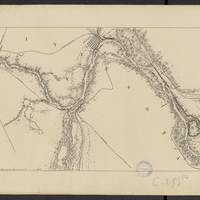
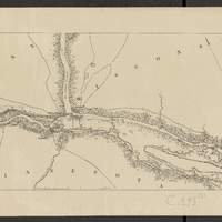
[1:63 360] (W 9316' - W 905' / N 45 - N 3850'). "Note : The position of the lights, as establlished in 1877 by the Light-House Board, are indicated on the map.". compiled from the maps prepared to accompany the reports of Bvt. Maj. Gen'l. G.K. Warren, U.S. Army Maj. Corps of Engineers, on bridging the Mississippi river between St. Paul and St. Louis ; and upon the improvement of navigation of the Mississippi River between the Falls of St. Anthony and the Rock Island Rapids, with additions from notes and surveys under the direction of Col. J.N. Macomb, Corps of Engineers. Comprends : 1 flle de titre ; 1 flle de tableau d'assemblage contenant un tableau des distances ; 26 flles de cartes numérotées de "sheet 1" à "sheet 26". Coordonnées géographiques d après Google Earth. Echelle d'après l'information : 1 inch to 1 mile
[1:63 360] (W 9316' - W 905' / N 45 - N 3850'). "Note : The position of the lights, as establlished in 1877 by the Light-House Board, are indicated on the map.". compiled from the maps prepared to accompany the reports of Bvt. Maj. Gen'l. G.K. Warren, U.S. Army Maj. Corps of Engineers, on bridging the Mississippi river between St. Paul and St. Louis ; and upon the improvement of navigation of the Mississippi River between the Falls of St. Anthony and the Rock Island Rapids, with additions from notes and surveys under the direction of Col. J.N. Macomb, Corps of Engineers. Comprends : 1 flle de titre ; 1 flle de tableau d'assemblage contenant un tableau des distances ; 26 flles de cartes numérotées de "sheet 1" à "sheet 26". Coordonnées géographiques d après Google Earth. Echelle d'après l'information : 1 inch to 1 mile
[1:63 360] (W 9316' - W 905' / N 45 - N 3850'). "Note : The position of the lights, as establlished in 1877 by the Light-House Board, are indicated on the map.". compiled from the maps prepared to accompany the reports of Bvt. Maj. Gen'l. G.K. Warren, U.S. Army Maj. Corps of Engineers, on bridging the Mississippi river between St. Paul and St. Louis ; and upon the improvement of navigation of the Mississippi River between the Falls of St. Anthony and the Rock Island Rapids, with additions from notes and surveys under the direction of Col. J.N. Macomb, Corps of Engineers. Comprends : 1 flle de titre ; 1 flle de tableau d'assemblage contenant un tableau des distances ; 26 flles de cartes numérotées de "sheet 1" à "sheet 26". Coordonnées géographiques d après Google Earth. Echelle d'après l'information : 1 inch to 1 mile
[1:63 360] (W 9316' - W 905' / N 45 - N 3850'). "Note : The position of the lights, as establlished in 1877 by the Light-House Board, are indicated on the map.". compiled from the maps prepared to accompany the reports of Bvt. Maj. Gen'l. G.K. Warren, U.S. Army Maj. Corps of Engineers, on bridging the Mississippi river between St. Paul and St. Louis ; and upon the improvement of navigation of the Mississippi River between the Falls of St. Anthony and the Rock Island Rapids, with additions from notes and surveys under the direction of Col. J.N. Macomb, Corps of Engineers. Comprends : 1 flle de titre ; 1 flle de tableau d'assemblage contenant un tableau des distances ; 26 flles de cartes numérotées de "sheet 1" à "sheet 26". Coordonnées géographiques d après Google Earth. Echelle d'après l'information : 1 inch to 1 mile