
Recherche dans les contenus numérisés
1887 items
-
Carta geologica d'Italia F° 253, Castroreale (isola di Sicilia) / R. Comitato geologico d'Italia ; rilevato nel 1880-81, riveduto nel 1881, da E. Cortese
Les numéros des feuilles adjacentes sont indiquées sur les bords de la carte. Carte de base : Carta 1:100 000 dell'Istituto Geografico Militare (réduction des cartes 1:25 000 et 1: 50 000 enregistrées par les Ingénieurs des Mines, 1877-82). Légende en italien. Impression : "R. Stab Lit e Cartogr. C. Virano Roma 1885". Feuille d'accompagnement : "Carta Geologica d'Italia, Isola di Sicilia : Sezioni geologiche. Tav III (Relativa ai fogli 253, 254, 262 della Carta Geologica al 100 000) / Ing. E. Cortese, 1885". Les coordonnées de la flle. sont au méridien de Rome (1229' à l'est de Greenwich). Les coordonnées E/N indiquées sont au méridien de Greenwich. Relief représenté par des hachures et des points cotés -
Carta geologica d'Italia F° 262, Monte Etna (isola di Sicilia) / R. Comitato geologico d'Italia ; rilevato nel 1881 da L. Mazzetti e E. Cortese ; riveduto nel 1882 da E. Cortese
Les numéros des feuilles adjacentes sont indiquées sur les bords de la carte. Carte de base : Carta 1:100 000 dell'Istituto Geografico Militare (réduction des cartes 1:25 000 et 1: 50 000 enregistrées par les Ingénieurs des Mines, 1877-82). Légende en italien. Impression : "R. Stab Lit e Cartogr. C. Virano Roma 1885". Feuille d'accompagnement : "Carta Geologica d'Italia, Isola di Sicilia : Sezioni geologiche. Tav III (Relativa ai fogli 253, 254, 262 della Carta Geologica al 100 000) / Ing. E. Cortese, 1885". Les coordonnées de la flle. sont au méridien de Rome (1229' à l'est de Greenwich). Les coordonnées E/N indiquées sont au méridien de Greenwich. Relief représenté par des hachures et des points cotés -
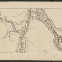
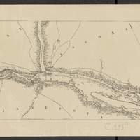
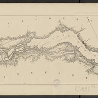
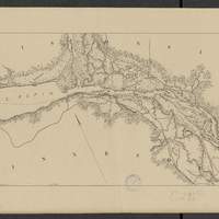
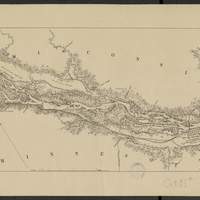
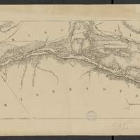
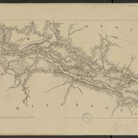
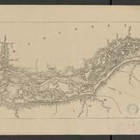
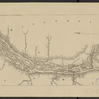
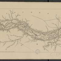
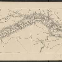
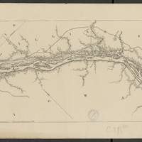
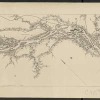
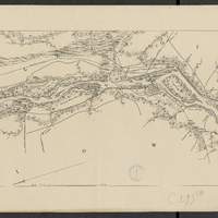
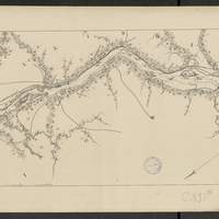
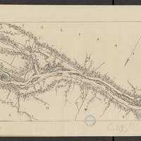
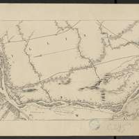
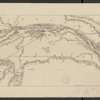
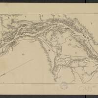
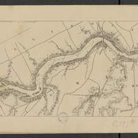
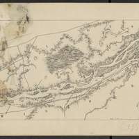
Map of the Mississippi River : from the Falls of Saint Anthony to the junction of the Illinois River in twenty-six sheets / drawn under the direction of Brevet Lieut. Col. F.U. Farquhar ; by F.S. Eastman
[1:63 360] (W 9316' - W 905' / N 45 - N 3850'). "Note : The position of the lights, as establlished in 1877 by the Light-House Board, are indicated on the map.". compiled from the maps prepared to accompany the reports of Bvt. Maj. Gen'l. G.K. Warren, U.S. Army Maj. Corps of Engineers, on bridging the Mississippi river between St. Paul and St. Louis ; and upon the improvement of navigation of the Mississippi River between the Falls of St. Anthony and the Rock Island Rapids, with additions from notes and surveys under the direction of Col. J.N. Macomb, Corps of Engineers. Comprends : 1 flle de titre ; 1 flle de tableau d'assemblage contenant un tableau des distances ; 26 flles de cartes numérotées de "sheet 1" à "sheet 26". Coordonnées géographiques d après Google Earth. Echelle d'après l'information : 1 inch to 1 mile -
Map of the Mississippi River : from the Falls of Saint Anthony to the junction of the Illinois River in twenty-six sheets / drawn under the direction of Brevet Lieut. Col. F.U. Farquhar ; by F.S. Eastman
[1:63 360] (W 9316' - W 905' / N 45 - N 3850'). "Note : The position of the lights, as establlished in 1877 by the Light-House Board, are indicated on the map.". compiled from the maps prepared to accompany the reports of Bvt. Maj. Gen'l. G.K. Warren, U.S. Army Maj. Corps of Engineers, on bridging the Mississippi river between St. Paul and St. Louis ; and upon the improvement of navigation of the Mississippi River between the Falls of St. Anthony and the Rock Island Rapids, with additions from notes and surveys under the direction of Col. J.N. Macomb, Corps of Engineers. Comprends : 1 flle de titre ; 1 flle de tableau d'assemblage contenant un tableau des distances ; 26 flles de cartes numérotées de "sheet 1" à "sheet 26". Coordonnées géographiques d après Google Earth. Echelle d'après l'information : 1 inch to 1 mile