
Recherche dans les contenus numérisés
854 items
-
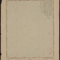
Sénégal 100,000 e flle no XV, Sangomar / levé par les officiers du Service géographique de l'Afrique occidentale française ; héliogravé et imprimé par le Service géographique de l'Armée
Travaux sur le terrain exécutés en 1907. Relief représenté par des courbes de niveau. En marge : tableau d'assemblage des feuilles voisines. Signale les villes, routes, sentiers, voies ferrées, rivières, points d'eau, types de végétation.... Sur la carte, la longitude est indiquée en grades et en degrés, sur la base du méridien de Paris. Les coordonnées ont été recalculées par rapport à Greenwich -
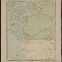
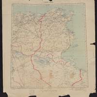
Sénégal 100,000 e flle no XXIII, Messira / levé par les officiers du Service géographique de l'Afrique occidentale française ; héliogravé et imprimé par le Service géographique de l'Armée
Travaux sur le terrain exécutés en 1908. Relief représenté par des courbes de niveau. En marge : tableau d'assemblage des feuilles voisines. Signale les villes, routes, sentiers, voies ferrées, rivières, points d'eau, types de végétation.... Sur la carte, la longitude est indiquée en grades et en degrés, sur la base du méridien de Paris. Les coordonnées ont été recalculées par rapport à Greenwich -
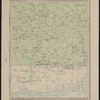
Sénégal 100,000 e flle no XXIV, Nioro / levé par les officiers du Service géographique de l'Afrique occidentale française ; héliogravé et imprimé par le Service géographique de l'Armée
Travaux sur le terrain exécutés en 1909. Relief représenté par des courbes de niveau. En marge : tableau d'assemblage des feuilles voisines. Signale les villes, routes, sentiers, voies ferrées, rivières, points d'eau, types de végétation.... Sur la carte, la longitude est indiquée en grades et en degrés, sur la base du méridien de Paris. Les coordonnées ont été recalculées par rapport à Greenwich -
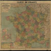
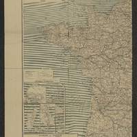
Carte de France : départements & chemins-de-fer, Belgique, bords du Rhin, Suisse, etc
Indique la découpage départemental de la France dans les années 1920. Cartons : Colonies françaises ; Algérie et Tunisie au [1/5 550 000] ; [Corse] -
-
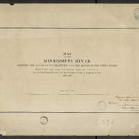
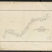
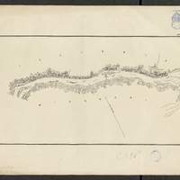
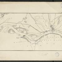
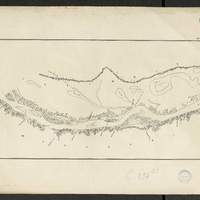
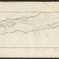
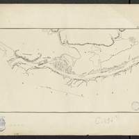
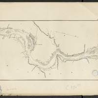
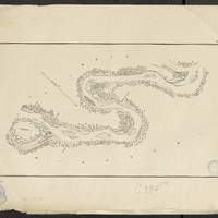
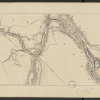
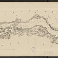
Map of the Mississippi River : between the mouth of the Illinois and the mouth of the Ohio Rivers / reduced from maps made from surveys under the direction of Lt. Col. W.F. Raynolds and Col. Jas. H. Simpson, Corps of Engineers, U.S.A., 1870-1878
[1:63 360] (W 9030' - W 896' / N 3859' - N 3657'). flles libres. Comprends : 1 flle de titre ; 1 flle index map, au 1:506 880 ; 9 flles de cartes numérotées de n1 à n9. Coordonnées géographiques d après Google Earth. Echelle d'après l'information : 1 inch to 1 mile -
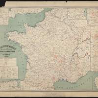
Nouvelle carte de France, Belgique, Bords du Rhin, Suisse, etc...
En carton : "Paris et ses environs" ; "Colonies françaises" ; "Algérie et Tunisie" ; "Corse". Au verso : Europe centrale. Chemins de fer, lignes de navigation, 1913 environ. Vers 1913. Coordonnées géographiques converties du méridien de Paris au méridien de Greenwich -
Carte des stations minérales, thermales et balnéaires de France et d'Algérie / dressée d'après les documents officiels par Mce. Beyne
Cartons : Algérie-Tunisie ; Seine et environs ; Pyrénées-Orles. ; Puy-de-Dôme ; Ardèche ; Cantal ; Htes.-Pyrénées. Indique la localisation des stations minérales, balnéaires, sanatorium et hôpitaux thermaux, avec légende qui indique la classification des sources (bicarbonatées, chlorurées, sulfatées, sulfurées, ferrugineuses) -
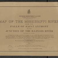
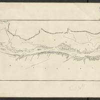
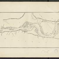
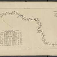
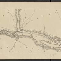
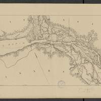
Map of the Mississippi River : from the Falls of Saint Anthony to the junction of the Illinois River in twenty-six sheets / drawn under the direction of Brevet Lieut. Col. F.U. Farquhar ; by F.S. Eastman
[1:63 360] (W 9316' - W 905' / N 45 - N 3850'). "Note : The position of the lights, as establlished in 1877 by the Light-House Board, are indicated on the map.". compiled from the maps prepared to accompany the reports of Bvt. Maj. Gen'l. G.K. Warren, U.S. Army Maj. Corps of Engineers, on bridging the Mississippi river between St. Paul and St. Louis ; and upon the improvement of navigation of the Mississippi River between the Falls of St. Anthony and the Rock Island Rapids, with additions from notes and surveys under the direction of Col. J.N. Macomb, Corps of Engineers. Comprends : 1 flle de titre ; 1 flle de tableau d'assemblage contenant un tableau des distances ; 26 flles de cartes numérotées de "sheet 1" à "sheet 26". Coordonnées géographiques d après Google Earth. Echelle d'après l'information : 1 inch to 1 mile -
Map of the Mississippi River : from the Falls of Saint Anthony to the junction of the Illinois River in twenty-six sheets / drawn under the direction of Brevet Lieut. Col. F.U. Farquhar ; by F.S. Eastman
[1:63 360] (W 9316' - W 905' / N 45 - N 3850'). "Note : The position of the lights, as establlished in 1877 by the Light-House Board, are indicated on the map.". compiled from the maps prepared to accompany the reports of Bvt. Maj. Gen'l. G.K. Warren, U.S. Army Maj. Corps of Engineers, on bridging the Mississippi river between St. Paul and St. Louis ; and upon the improvement of navigation of the Mississippi River between the Falls of St. Anthony and the Rock Island Rapids, with additions from notes and surveys under the direction of Col. J.N. Macomb, Corps of Engineers. Comprends : 1 flle de titre ; 1 flle de tableau d'assemblage contenant un tableau des distances ; 26 flles de cartes numérotées de "sheet 1" à "sheet 26". Coordonnées géographiques d après Google Earth. Echelle d'après l'information : 1 inch to 1 mile